Image illustrating the map of California
Comparedoo
Image illustrating the map of Ukraine
Header top banner ads

California vs Ukraine (Statistical Comparison)

Published: Monday, 21th October 2024

Recently Updated: Monday, 7th April 2025

Comparedoo.com welcomes you to explore the detailed comparison between California and Ukraine.
Dive in and compare them across different aspects like cost of living, standard of living, geography, demographics, environment, society, economy, health factors and many more.
Enjoy exploring!

Header top banner ads

Pictorial Representation

California
Map
Pictorial representation of map of California
Flag
Image illustrating the flag of California
State Seal
Image showing the State Seal of California
Ukraine
Map
Pictorial representation of map of Ukraine
Flag
Image illustrating the flag of Ukraine
Coat of Arms / Emblem
Image showing the Coat of Arms of Ukraine
Header top banner ads
Image representing an indicator
Indicators
Image illustrating an indicator
Pictorial representation of map of california
California
Image illustrating the flag of california
Pictorial representation of map of ukraine
Ukraine
Image illustrating the flag of ukraine
Official Name
Visual representation of official name of any country
State of CaliforniaUkraine
Continent
Visual representation of all continents in the world
North AmericaEurope
Landlocked Status
Image Depicting whether the status is landlocked or not.
Not LandlockedNot Landlocked
Capital City
Visual representation of a capital city of any specific country
SacramentoKyiv
Latitude
Image Depicting Latitide lines in World Map
36° 07′ 00″ N48° 0′ 0″ N
Longitude
Image Depicting Longitude lines in World Map
119° 31′ 00″ W31° 0′ 0″ E

Size Comparison

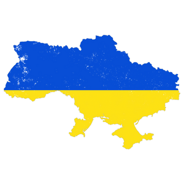
The total area of California is 423,967 sq km, and the total area of Ukraine is 603,628 sq km. California is smaller than Ukraine by 179,661 sq km. California is around 1.42 times smaller than Ukraine.

Image representing an indicator
Indicators
Image illustrating an indicator
Pictorial representation of map of california
California
Image illustrating the flag of california
Pictorial representation of map of ukraine
Ukraine
Image illustrating the flag of ukraine
Area in Square Kilometers
Illustration of area in Square Kilometers
423,967 Sq km603,628 Sq km
Difference[179,661 Square Kilometers]
Area in Square Mile
Illustration of area in Square Mile
163,695 Sq mi233,062 Sq mi
Difference[69,367 Square Mile]
Water % in Area
Illustration of water percentage area of any country in the world
4.8 %3.8 %
Header top banner ads

Geographical Factors Comparison

Image representing an indicator
Indicators
Image illustrating an indicator
Pictorial representation of map of california
California
Image illustrating the flag of california
Pictorial representation of map of ukraine
Ukraine
Image illustrating the flag of ukraine
Largest City
Visual representation of the Largest City of any country
Los AngelesKyiv
Demonyms
Image depicting demonyms of any specific country
CalifornianUkrainian
Official Languages
Image depicting the official languages of any specific country
EnglishUkrainian
Currency Name
Visual representation of currency name of any specific country
United States DollarHryvnia
Currency Symbol
Visual representation of currency symbol of any specific country
USDUAH
Start of Week
Image showing the first working day of week of any specific country
SundayMonday

The people of California are called Californian, and the people of Ukraine are called Ukrainian.

Image representing an indicator
Indicators
Image illustrating an indicator
Pictorial representation of map of california
California
Image illustrating the flag of california
Pictorial representation of map of ukraine
Ukraine
Image illustrating the flag of ukraine
Driving Side
Visual representation of driving side of any specific country
RightRight
Calling Code
Image depicting calling code of any specific country
+1+380
Internet TLD or Official Website
Image depicting Internet Top Level Domain also called tld of any specific country
ca.gov.ua, .укр
ISO 3166 Code
Image depicting ISO 3166 Code of any specific country
US-CAUA
Header top banner ads

State/National Symbols Comparison

Image representing an indicator
Indicators
Image illustrating an indicator
Pictorial representation of map of california
California
Image illustrating the flag of california
Pictorial representation of map of ukraine
Ukraine
Image illustrating the flag of ukraine
State/National Anthem Title (Native)
Visual representation of national anthem of any country in their native language
I Love You, CaliforniaЩе не вмерла Україна (Shche ne vmerla Ukrainy)
State/National Anthem Title (In English)
Visual representation of national anthem of any country in English language
I Love You, CaliforniaState Anthem of Ukraine
State/National Animal
Visual representation of national animal of any specific country
California Grizzly BearNightingale
State/National Bird
Visual representation of national bird of any specific country
California QuailWhite Stork
State/National Flower
Visual representation of national flower of any specific country
California PoppySunflower
State/National Sport
Visual representation of national sport of any specific country
SurfingFootball
State/National Colors
Visual representation of national colors of any specific country
Blue and GoldBlue and yellow
Header top banner ads

Time Differences Comparison

Image representing an indicator
Indicators
Image illustrating an indicator
Pictorial representation of map of california
California
Image illustrating the flag of california
Pictorial representation of map of ukraine
Ukraine
Image illustrating the flag of ukraine
Current Date
Visual representation of current date of any specific country
Monday, 7th April, 2025Monday, 7th April, 2025
Current Time
Visual representation of current time of any specific country
09:16 AM07:16 PM
Timezones
Visual representation of timezones of any specific country
UTC−08:00 (Pacific Standard Time)
UTC−07:00 (Pacific Daylight Time)
UTC+2 (Eastern European Time)
UTC+3 (Eastern European Summer Time)
Current Timezone
Visual representation of current timezone of any specific country
UTC−08:00 (Pacific Standard Time)
UTC+2 (Eastern European Time)
Daylight Saving Time
Visual representation of Daylight Saving Time of any specific country
ObservedObserved
Daylight Saving Time Start
Visual representation of Daylight Saving Time Start of any specific country
Sunday, 10th March, 2024Sunday, 31st March, 2024
Daylight Saving Time End
Visual representation of Daylight Saving Time End of any specific country
Sunday, 3rd November, 2024Sunday, 27th October, 2024
Daylight Saving Time Duration
Visual representation of Daylight Saving Time Duration of any specific country
238 Days211 days

The current time and date in California is [09:16 AM], [Monday, 7th April, 2025 ].

The current time and date in Ukraine is [07:16 PM], [Monday, 7th April, 2025].

California is [ 10 hours ] behind of Ukraine.

Header top banner ads

Population Comparison

Based on the elaboration of latest World Bank Data, the total population of California as of 2023 is estimated to be around 39538223, and the total population of Ukraine as of 2023 is estimated to be around 37,000,000.

As per the above data, we can say that in the year 2023, California had 2,538,223 more people than Ukraine.

Header top banner ads

Weather Comparison

Image representing an indicator
Indicators
Image illustrating an indicator
Pictorial representation of map of california
California
Image illustrating the flag of california
Pictorial representation of map of ukraine
Ukraine
Image illustrating the flag of ukraine
[ LATEST WEATHER DATA ]
Place
Visual representation of place of any country
SacramentoKyiv
Current Time
Visual representation of current time of any specific country
09:16 AM07:16 PM
Current Weather
Visual representation of current weather of any specific place in a country
Overcast CloudsVisual representation of Overcast Clouds in Sacramento
Light SnowVisual representation of Light Snow in Kyiv
Current Temperature
Visual representation of current temperature of any specific place in a country
13.92 Degree Celsius-0.16 Degree Celsius
Wind Speed
Visual representation of Speed of Wind Flowing of any specific place in a country
3.09 km/hr, 190 Degree0.89 km/hr, 271 Degree
Humidity
Visual representation of Humidity of any specific place in a country
87 %76 %
Header top banner ads

We hope you enjoyed the detailed guide on the general comparsion between California and Ukraine.

For more side-by-side comparsion between Countries, States and Cities, you can use the search box above or click the links below.

The Comparedoo.com family sincerely appreciates your time with us. We look forward to seeing you on our other pages.

Pictorial representation of the map of California
California
v/s
Mali
Pictorial representation of the map of Mali
Pictorial representation of the map of California
California
v/s
Italy
Pictorial representation of the map of Italy
Pictorial representation of the map of California
California
v/s
Gambia
Pictorial representation of the map of Gambia
Pictorial representation of the map of California
California
v/s
New Zealand
Pictorial representation of the map of New Zealand
Pictorial representation of the map of California
California
v/s
Cabo Verde
Pictorial representation of the map of Cabo Verde
Pictorial representation of the map of California
California
v/s
Australia
Pictorial representation of the map of Australia
Pictorial representation of the map of California
California
v/s
France
Pictorial representation of the map of France
Pictorial representation of the map of California
California
v/s
Slovakia
Pictorial representation of the map of Slovakia
Pictorial representation of the map of California
California
v/s
Saudi Arabia
Pictorial representation of the map of Saudi Arabia
Pictorial representation of the map of California
California
v/s
Laos
Pictorial representation of the map of Laos
Pictorial representation of the map of California
California
v/s
Iran
Pictorial representation of the map of Iran
Pictorial representation of the map of California
California
v/s
Sao Tome and Principe
Pictorial representation of the map of Sao Tome and Principe