Image illustrating the map of United States
Comparedoo
Search box second div image
Header top banner ads

List of all countries in [North America]

Published: Monday, 21th October 2024
Recently Updated: Sunday, 22nd December 2024

Map and Description

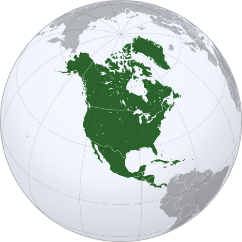
Map of North America and outline showing for all countries in North America
IndicatorValue
Total Countries23 as per United Nations
DemonymNorth American
Area in Sq Kilometers24.709 Million Sq Km
Area in Sq Mile9.54 million Sq Mi
Population (2021)592,296,233
Population Density (2021)25.7 / Square KM [66.4 / Square Mile]
TimezonesUTC−10:00 to UTC+00:00
Biggest CountryCanada
Smallest CountryAntigua and Barbuda
Gross Domestic Product (2022)$29.01 trillion
Internet TLDn/a
Header top banner ads

Countries List

There are total of 23 countries in North America. You can click the countries links below and compare them further to other countries, cities and states in the world.

Pictorial representation of map of Antigua and Barbuda
Antigua and Barbuda
Image illustrating the flag of Antigua and Barbuda
Pictorial representation of map of Bahamas
Bahamas
Image illustrating the flag of Bahamas
Pictorial representation of map of Barbados
Barbados
Image illustrating the flag of Barbados
Pictorial representation of map of Belize
Belize
Image illustrating the flag of Belize
Pictorial representation of map of Canada
Canada
Image illustrating the flag of Canada
Pictorial representation of map of Costa Rica
Costa Rica
Image illustrating the flag of Costa Rica
Pictorial representation of map of Cuba
Cuba
Image illustrating the flag of Cuba
Pictorial representation of map of Dominica
Dominica
Image illustrating the flag of Dominica
Pictorial representation of map of Dominican Republic
Dominican Republic
Image illustrating the flag of Dominican Republic
Pictorial representation of map of El Salvador
El Salvador
Image illustrating the flag of El Salvador
Pictorial representation of map of Grenada
Grenada
Image illustrating the flag of Grenada
Pictorial representation of map of Guatemala
Guatemala
Image illustrating the flag of Guatemala
Pictorial representation of map of Haiti
Haiti
Image illustrating the flag of Haiti
Pictorial representation of map of Honduras
Honduras
Image illustrating the flag of Honduras
Pictorial representation of map of Jamaica
Jamaica
Image illustrating the flag of Jamaica
Pictorial representation of map of Mexico
Mexico
Image illustrating the flag of Mexico
Pictorial representation of map of Nicaragua
Nicaragua
Image illustrating the flag of Nicaragua
Pictorial representation of map of Panama
Panama
Image illustrating the flag of Panama
Pictorial representation of map of Saint Kitts and Nevis
Saint Kitts and Nevis
Image illustrating the flag of Saint Kitts and Nevis
Pictorial representation of map of Saint Lucia
Saint Lucia
Image illustrating the flag of Saint Lucia
Pictorial representation of map of Saint Vincent and the Grenadines
Saint Vincent and the Grenadines
Image illustrating the flag of Saint Vincent and the Grenadines
Pictorial representation of map of Trinidad and Tobago
Trinidad and Tobago
Image illustrating the flag of Trinidad and Tobago
Pictorial representation of map of United States
United States
Image illustrating the flag of United States