

Published: Monday, 21th October 2024
Comparedoo.com welcomes you to explore the detailed comparison between Georgia (USA) and Washington.
Dive in and compare them across different aspects like cost of living, standard of living, geography, demographics, environment, society, economy, health factors and many more.
Enjoy exploring!


 Indicators  | Georgia (USA)  | Washington  |
|---|---|---|
Official Name  | State of Georgia | State of Washington |
Nicknames  | The Peach State | The Evergreen State |
Landlocked Status  | Not Landlocked | Not Landlocked |
Capital City  | Atlanta | Olympia |
Latitude  | 32° 15′ 48″ N | 47° 22′ 00″ N |
Longitude  | 83° 34′ 00″ W | 121° 00′ 00″ W |
Indicators | Georgia (USA) | Washington |
|---|---|---|
Motto (Latin)  | n/a | n/a |
Motto (English)  | Wisdom, Justice, Moderation | By and By |
State Anthem  | Georgia on My Mind | Washington, My Home |
Largest City  | Atlanta | Seattle |
Demonyms  | Georgian | Washingtonian |
Internet TLD or Official Website  | georgia.gov | wa.gov |
ISO 3166 Code  | US-GA | US-WA |
The people of Georgia (USA) are called Georgian, and the people of Washington are called Washingtonian.
The total area of Georgia (USA) is 59,425 Square Mile, and the total area of Washington is 71,298 Square Mile. Georgia (USA) is smaller than Washington by 11,873 sq mile. Georgia (USA) is around 1.20 times smaller than Washington.
Indicators | Georgia (USA) | Washington |
|---|---|---|
Area in Square Mile  | 59,425 Sq Mile | 71,298 Sq Mile |
| Difference | [ 11,873 Square Mile] | |
Area in Square Kilometers  | 153,910 Sq km | 184,661 Sq km |
| Difference | [ 30,751 Square Kilometers] | |
Water % in Area  | 3.2 % | 6.8 % |
Indicators | Georgia (USA) | Washington |
|---|---|---|
State Bird  | Brown Thrasher | Willow Goldfinch |
State Flower  | Cherokee Rose | Coast Rhododendron |
State Sport  | None | None |
State Tree  | Southern Live Oak | Western Hemlock |
State Colors  | Red, White, Gold, and Blue | Green and Gold |
Indicators | Georgia (USA) | Washington |
|---|---|---|
Current Date  | Thursday, 10th April, 2025 | Thursday, 10th April, 2025 |
Current Time  | 05:43 PM | 02:43 PM |
Timezones  | UTC−05:00 (Eastern Standard Time) UTC−04:00 (Eastern Daylight Time) | UTC−08:00 (Pacific Standard Time) UTC−07:00 (Pacific Daylight Time) |
Current Timezone  | UTC−05:00 (Eastern Standard Time) | UTC−08:00 (Pacific Standard Time) |
Daylight Saving Time | Observed | Observed |
Daylight Saving Time Start  | Sunday, 10th March, 2024 | Sunday, 10th March, 2024 |
Daylight Saving Time End  | Sunday, 3rd November, 2024 | Sunday, 3rd November, 2024 |
Daylight Saving Time Duration  | 238 Days | 238 Days |
The current time and date in Georgia (USA) is [05:43 PM], [Thursday, 10th April, 2025 ].
The current time and date in Washington is [02:43 PM], [Thursday, 10th April, 2025].
Georgia (USA) is [ 3 hours ] ahead of Washington.
Based on the elaboration of latest United States Census Bureau Data, the total population of Georgia (USA) as of 2023 is estimated to be around 10711908, and the total population of Washington as of 2023 is estimated to be around 7705281.
As per the above data, we can say that in the year 2023, Georgia (USA) had 3,006,627 less people than Washington.
Indicators | Georgia (USA) | Washington |
|---|---|---|
Total Population  | 10711908 | 7705281 |
| Difference | [3,006,627] | |
Veterans  | 7.3 % | 7.7 % |
Male Veterans  | 86.5 % | 88.5 % |
Female Veterans  | 13.5 % | 11.5 % |
Indicators | Georgia (USA) | Washington |
|---|---|---|
| [ LATEST WEATHER DATA ] | ||
Place  | Atlanta | Olympia |
Current Time | 05:43 PM | 02:43 PM |
Current Weather  | Scattered Clouds | Light Rain |
Current Temperature  | 23.69 Degree Celsius | 13.48 Degree Celsius |
Wind Speed  | 6.17 km/hr, 240 Degree | 4.02 km/hr, 227 Degree |
Humidity 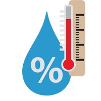 | 37 % | 91 % |
We hope you enjoyed the detailed guide on the general information comparsion between Georgia (USA) and Washington.
For more side-by-side comparsion between Countries, States and Cities, you can use the search box above or click the links below.
The Comparedoo.com family sincerely appreciates your time with us. We look forward to seeing you on our other pages.