Image illustrating the map of Idaho
Comparedoo
Image illustrating the map of Delaware
Header top banner ads

Idaho vs Delaware (Statistical Comparison)

Published: Monday, 21th October 2024

Recently Updated: Wednesday, 9th April 2025

Comparedoo.com welcomes you to explore the detailed comparison between Idaho and Delaware.
Dive in and compare them across different aspects like cost of living, standard of living, geography, demographics, environment, society, economy, health factors and many more.
Enjoy exploring!

Header top banner ads

Pictorial Representation

Idaho
Map
Pictorial representation of the map of Idaho
Flag
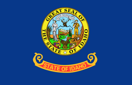
Image illustrating the flag of Idaho
State Seal
Image showing the state seal of Idaho
Delaware
Map
Pictorial representation of the map of Delaware
Flag
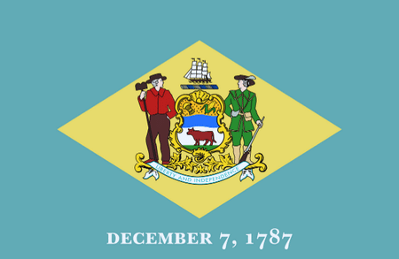
Image illustrating the flag of Delaware
State Seal
Image showing the state seal of Delaware
Header top banner ads
Image representing an indicator
Indicators
Image illustrating an indicator
Pictorial representation of map of idaho
Idaho
Image illustrating the flag of idaho
Pictorial representation of map of delaware
Delaware
Image illustrating the flag of delaware
Official Name
Visual representation of official name of any country
State of IdahoState of Delaware
Nicknames
Visual representation of all continents in the world
The Gem State The First State
Landlocked Status
Image Depicting whether the status is landlocked or not.
LandlockedNot Landlocked
Capital City
Visual representation of a capital city of any specific country
BoiseDover
Latitude
Image Depicting Latitide lines in World Map
44° 14′ 24″ N39° 19′ 08″ N
Longitude
Image Depicting Longitude lines in World Map
114° 08′ 00″ W75° 24′ 00″ W
Header top banner ads
Image representing an indicator
Indicators
Image illustrating an indicator
Pictorial representation of map of idaho
Idaho
Image illustrating the flag of idaho
Pictorial representation of map of delaware
Delaware
Image illustrating the flag of delaware
Motto (Latin)
Visual representation of official name of any country
Esto perpetua n/a
Motto (English)
Visual representation of all continents in the world
Let It Be Perpetual Liberty and Independence
State Anthem
Image Depicting whether the status is landlocked or not.
Here We Have IdahoOur Delaware
Largest City
Visual representation of a largest city of any specific state
BoiseWilmington
Demonyms
Image depicting demonyms of any specific country
IdahoanDelawarean
Internet TLD or Official Website
Image depicting Internet Top Level Domain also called tld of any specific country
idaho.govde.gov
ISO 3166 Code
Image depicting ISO 3166 Code of any specific country
US-IDUS-DE

The people of Idaho are called Idahoan, and the people of Delaware are called Delawarean.

Size Comparison

The total area of Idaho is 83,569 Square Mile, and the total area of Delaware is 2,489 Square Mile. Idaho is bigger than Delaware by 81,080 sq mile. Idaho is around 33.58 times bigger than Delaware.

Image representing an indicator
Indicators
Image illustrating an indicator
Pictorial representation of map of idaho
Idaho
Image illustrating the flag of idaho
Pictorial representation of map of delaware
Delaware
Image illustrating the flag of delaware
Area in Square Mile
Illustration of area in Square Mile
83,569 Sq Mile 2,489 Sq Mile
Difference [ 81,080 Square Mile]
Area in Square Kilometers
Illustration of area in Square Kilometers
216,443 Sq km6,446 Sq km
Difference [ 209,997 Square Kilometers]
Water % in Area
Illustration of water percentage area of any country in the world
1.1 %21.7 %
Header top banner ads

State Symbols Comparison

Image representing an indicator
Indicators
Image illustrating an indicator
Pictorial representation of map of idaho
Idaho
Image illustrating the flag of idaho
Pictorial representation of map of delaware
Delaware
Image illustrating the flag of delaware
State Bird
Visual representation of national bird of any specific country
Mountain BluebirdBlue Hen Chicken
State Flower
Visual representation of state flower of any specific country
SyringaPeach Blossom
State Sport
Visual representation of national sport of any specific country
NoneNone
State Tree
Visual representation of national colors of any specific country
Western White PineAmerican Holly
State Colors
Visual representation of state colors of any specific US State
Red, White, and BlueColonial Blue and Buff
Header top banner ads

Time Differences Comparison

Image representing an indicator
Indicators
Image illustrating an indicator
Pictorial representation of map of idaho
Idaho
Image illustrating the flag of idaho
Pictorial representation of map of delaware
Delaware
Image illustrating the flag of delaware
Current Date
Visual representation of current date of any specific country
Yet to UpdateYet to Update
Current Time
Visual representation of current time of any specific country
Yet to UpdateYet to Update
Timezones
Visual representation of timezones of any specific country
UTC−07:00 (Mountain Standard Time)
UTC−06:00 (Mountain Daylight Time)
UTC−08:00 (Pacific Standard Time)
UTC−07:00 (Pacific Daylight Time)
UTC−05:00 (Eastern Standard Time)
UTC−04:00 (Eastern Daylight Time)
Current Timezone
Visual representation of current timezone of any specific country
UTC−07:00 (Mountain Standard Time)
UTC−08:00 (Pacific Standard Time)
UTC−05:00 (Eastern Standard Time)
Daylight Saving Time
Visual representation of Daylight Saving Time of any specific country
ObservedObserved
Daylight Saving Time Start
Visual representation of Daylight Saving Time Start of any specific country
Sunday, 10th March, 2024Sunday, 10th March, 2024
Daylight Saving Time End
Visual representation of Daylight Saving Time End of any specific country
Sunday, 3rd November, 2024Sunday, 3rd November, 2024
Daylight Saving Time Duration
Visual representation of Daylight Saving Time Duration of any specific country
238 Days238 Days
Header top banner ads

Population Comparison

Based on the elaboration of latest United States Census Bureau Data, the total population of Idaho as of 2023 is estimated to be around 1839106, and the total population of Delaware as of 2023 is estimated to be around 989948.

As per the above data, we can say that in the year 2023, Idaho had 849,158 less people than Delaware.

Image representing an indicator
Indicators
Image illustrating an indicator
Pictorial representation of map of idaho
Idaho
Image illustrating the flag of idaho
Pictorial representation of map of delaware
Delaware
Image illustrating the flag of delaware
Total Population
Illustration of area in Square Mile
1839106 989948
Difference [849,158]
Veterans
Visual representation Veterans
7.9 %7.3 %
Male Veterans
Visual representation of Male Veterans
90.3 %90.4 %
Female Veterans
Visual representation of Female Veterans
9.7 %9.6 %
Header top banner ads

Weather Comparison

Image representing an indicator
Indicators
Image illustrating an indicator
Pictorial representation of map of idaho
Idaho
Image illustrating the flag of idaho
Pictorial representation of map of delaware
Delaware
Image illustrating the flag of delaware
[ LATEST WEATHER DATA ]
Place
Visual representation of place of any country
Yet to Update Yet to Update
Current Time
Visual representation of current time of any specific country
Yet to UpdateYet to Update
Current Weather
Visual representation of current weather of any specific place in a country
Yet to UpdateYet to Update
Current Temperature
Visual representation of current temperature of any specific place in a country
Yet to UpdateYet to Update
Wind Speed
Visual representation of Speed of Wind Flowing of any specific place in a country
Yet to UpdateYet to Update
Humidity
Visual representation of Humidity of any specific place in a country
Yet to UpdateYet to Update
Header top banner ads

We hope you enjoyed the detailed guide on the general information comparsion between Idaho and Delaware.

For more side-by-side comparsion between Countries, States and Cities, you can use the search box above or click the links below.

The Comparedoo.com family sincerely appreciates your time with us. We look forward to seeing you on our other pages.

Pictorial representation of the map of Idaho
Idaho
v/s
Tennessee
Pictorial representation of the map of Tennessee
Pictorial representation of the map of Idaho
Idaho
v/s
Connecticut
Pictorial representation of the map of Connecticut
Pictorial representation of the map of Idaho
Idaho
v/s
California
Pictorial representation of the map of California
Pictorial representation of the map of Idaho
Idaho
v/s
Oregon
Pictorial representation of the map of Oregon
Pictorial representation of the map of Idaho
Idaho
v/s
Minnesota
Pictorial representation of the map of Minnesota
Pictorial representation of the map of Idaho
Idaho
v/s
South Dakota
Pictorial representation of the map of South Dakota
Pictorial representation of the map of Idaho
Idaho
v/s
New Hampshire
Pictorial representation of the map of New Hampshire
Pictorial representation of the map of Idaho
Idaho
v/s
New Mexico
Pictorial representation of the map of New Mexico
Pictorial representation of the map of Idaho
Idaho
v/s
Mississippi
Pictorial representation of the map of Mississippi
Pictorial representation of the map of Idaho
Idaho
v/s
West Virginia
Pictorial representation of the map of West Virginia
Pictorial representation of the map of Idaho
Idaho
v/s
Massachusetts
Pictorial representation of the map of Massachusetts
Pictorial representation of the map of Idaho
Idaho
v/s
Vermont
Pictorial representation of the map of Vermont