

Published: Monday, 21th October 2024
Comparedoo.com welcomes you to explore the detailed comparison between Maine and Vermont.
Dive in and compare them across different aspects like cost of living, standard of living, geography, demographics, environment, society, economy, health factors and many more.
Enjoy exploring!


 Indicators  | Maine  | Vermont  |
|---|---|---|
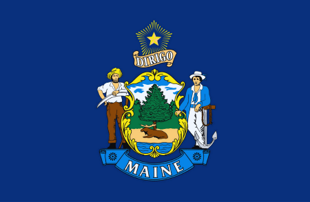
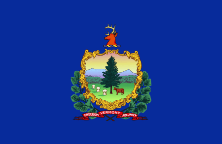
Official Name  | State of Maine | State of Vermont |
Nicknames  | The Pine Tree State | The Green Mountain State |
Landlocked Status  | Not Landlocked | Landlocked |
Capital City  | Augusta | Montpelier |
Latitude  | 44° 42′ 40″ N | 44° 04′ 00″ N |
Longitude  | 69° 15′ 00″ W | 72° 31′ 00″ W |
Indicators | Maine | Vermont |
|---|---|---|
Motto (Latin)  | Dirigo | Stella quarta decima fulgeat |
Motto (English)  | I Lead | May the Fourteenth Star Shine Bright |
State Anthem  | State of Maine Song | These Green Mountains |
Largest City  | Portland | Burlington |
Demonyms  | Mainer | Vermonter |
Internet TLD or Official Website  | maine.gov | vermont.gov |
ISO 3166 Code  | US-ME | US-VT |
The people of Maine are called Mainer, and the people of Vermont are called Vermonter.
The total area of Maine is 35,380 Square Mile, and the total area of Vermont is 9,616 Square Mile. Maine is bigger than Vermont by 25,764 sq mile. Maine is around 3.68 times bigger than Vermont.
Indicators | Maine | Vermont |
|---|---|---|
Area in Square Mile  | 35,380 Sq Mile | 9,616 Sq Mile |
| Difference | [ 25,764 Square Mile] | |
Area in Square Kilometers  | 91,633 Sq km | 24,906 Sq km |
| Difference | [ 66,727 Square Kilometers] | |
Water % in Area  | 12.8 % | 4.2 % |
Indicators | Maine | Vermont |
|---|---|---|
State Bird  | Black-capped Chickadee | Hermit Thrush |
State Flower  | White Pine Cone and Tassel | Red Clover |
State Sport  | None | None |
State Tree  | Eastern White Pine | Sugar Maple |
State Colors  | Blue and Gold | Green and Gold |
Indicators | Maine | Vermont |
|---|---|---|
Current Date  | Saturday, 5th April, 2025 | Saturday, 5th April, 2025 |
Current Time  | 07:09 PM | 07:09 PM |
Timezones  | UTC−05:00 (Eastern Standard Time) UTC−04:00 (Eastern Daylight Time) | UTC−05:00 (Eastern Standard Time) UTC−04:00 (Eastern Daylight Time) |
Current Timezone  | UTC−05:00 (Eastern Standard Time) | UTC−05:00 (Eastern Standard Time) |
Daylight Saving Time | Observed | Observed |
Daylight Saving Time Start  | Sunday, 10th March, 2024 | Sunday, 10th March, 2024 |
Daylight Saving Time End  | Sunday, 3rd November, 2024 | Sunday, 3rd November, 2024 |
Daylight Saving Time Duration  | 238 Days | 238 Days |
The current time and date in Maine is [07:09 PM], [Saturday, 5th April, 2025 ].
The current time and date in Vermont is [07:09 PM], [Saturday, 5th April, 2025].
So the current time and date in Maine and Vermont are same.
Based on the elaboration of latest United States Census Bureau Data, the total population of Maine as of 2023 is estimated to be around 1362359, and the total population of Vermont as of 2023 is estimated to be around 643077.
As per the above data, we can say that in the year 2023, Maine had 719,282 less people than Vermont.
Indicators | Maine | Vermont |
|---|---|---|
Total Population  | 1362359 | 643077 |
| Difference | [719,282] | |
Veterans  | 9 % | 6.5 % |
Male Veterans  | 92.1 % | 91 % |
Female Veterans  | 7.9 % | 9 % |
Indicators | Maine | Vermont |
|---|---|---|
| [ LATEST WEATHER DATA ] | ||
Place  | Augusta | Montpelier |
Current Time | 07:09 PM | 07:09 PM |
Current Weather  | Mist | Overcast Clouds |
Current Temperature  | 2.14 Degree Celsius | 3.87 Degree Celsius |
Wind Speed  | 3.09 km/hr, 170 Degree | 6.17 km/hr, 180 Degree |
Humidity  | 90 % | 88 % |
We hope you enjoyed the detailed guide on the general information comparsion between Maine and Vermont.
For more side-by-side comparsion between Countries, States and Cities, you can use the search box above or click the links below.
The Comparedoo.com family sincerely appreciates your time with us. We look forward to seeing you on our other pages.